Day 41. Halton to Porth-y-waen

Offa’s Dyke Day 1.
Distance today: 18.8 miles.
Total distance: 818.7 miles.
Accommodation: wild camping.

10 years together and all I could manage to sort out in time was a (lovely) cake from Baked By Beth and some flowers from The Lily Pad. Sorry Pen. Love you.

Before heading off from the campsite, I made a mental note that some day I would definitely return. It was a special place. What was hard to believe was that it was barely 10 minutes walk from the busy A483 – a road I had driven along many, many times on my way to North Wales. And should you need it, there was also a McDonalds. Mel had told me the best route to get to Chirk and this involved taking the quiet lane which joined onto the B5070. If ever I needed an example of the direct correlation between the fast food industry and the amount of litter/waste it generated, I need look no further than all the discarded McDonalds wrappers, cups and boxes strewn everywhere along the lane. I found it very distressing. What is it with some people? That is just pure fucking laziness. Not forgetting the business model which encouraged this to happen. What do they call it? Negative externalities.

I got to Chirk and decided it didn’t really have much to offer. I couldn’t find either a decent café or a place to buy a map. I stocked up with a few bits and pieces at the Spar convenience store where I very nearly lost my trekking poles. (I left them there and it later took a worryingly long time for my brain to retrace all my steps). Heading along the B4500 as it followed River Ceiriog, Caffi Wylfa was meant to provide tourist information as well as being a café. Sadly, Information was closed so still no map. After a quick cup of tea, I carried on along the road for a couple miles until I reached the point where I turned off to join Offa’s Dyke.

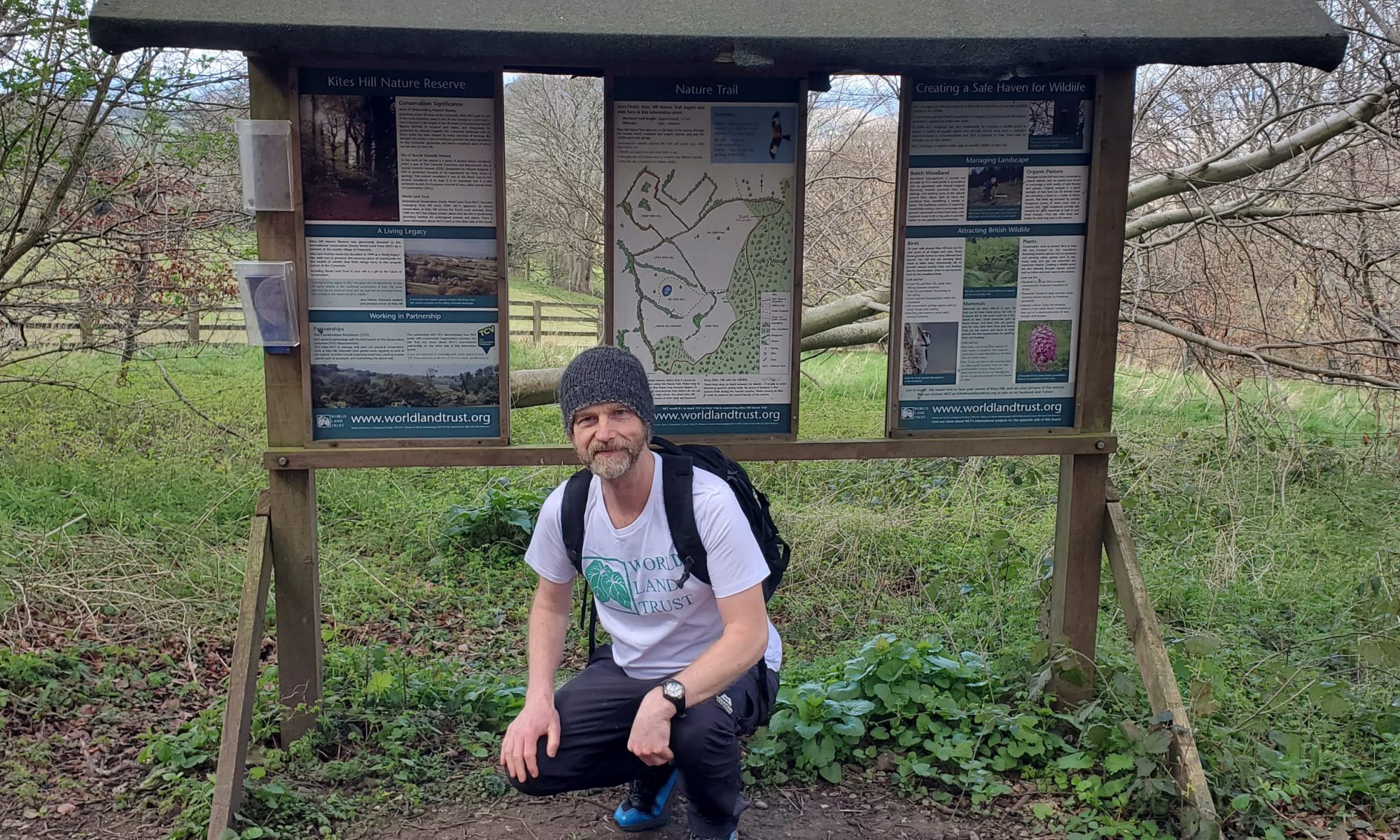
Offa’s Dyke. Section 19 out of 26. At 129+ miles, it was a big one, and more significantly from looking at the altitude plot, I knew I was in for a serious amount of hills. By way of introduction, my first job was to climb up a lot of steep steps which continued on as a steep path. The contrast to the infuriating Maelor Way was almost immediate. The views were just better. And, get this, someone had been along and strimmed the path! It might be the honeymoon period, but I was already feeling a lot happier.

The route passed through some lovely wooded areas and in one of them, I bumped into a woman walking her dog. We chatted as we walked, putting the world to rights, particularly when it came to the environment.

When I reached Trefonen, I was going to treat myself to a pint but the Barley Mow Inn didn’t open for another hour so I had to settle for an ice cream from the post office instead. As it got later, I realized I wasn’t going to find a campsite and started to keep an eye open for wild camping possibilities. At Porth-y-Waen, the trail passed near to Vownog Farm which also appeared to be home to a business called Lavender Kitchen. Subconsciously, I was maybe hoping that people trading under that name would somehow be sympathetic. Happily for me, they were. I found a woman in her garden and asked if there was anywhere I could pitch a tent. She was very cheerful, running through the various options – I think they’re going to put sheep in this field but you should be okay in that field. The field in question was just a little bit back up the lane and would do me fine. I picked a corner hoping that from a distance my tent would blend into the hedge behind. I just needed to clear away a couple of thistles before I pitched my tent and that was me done.

Day 42. Porth-y-waen to Buttington

Offa’s Dyke Day 2.
Distance today: 15.2 miles.
Total distance: 833.8 miles.
Accommodation: campsite.

Looked like it was going to be another hot one and what better way to start the day than with a steep climb. When I finally emerged from a wooded trail where it was easy to believe I was in the middle of nowhere, I bizarrely found myself on the edge of a golf course. To add to the surrealness, 2 of the early morning golfers were using remote control golf carts to carry their bags. Maybe I should get one of those.

Next stop, Llanymynech. With no disrespect to the village, I couldn’t help thinking it sounded like an injury. Ooh, I’ve llanyed my neck. I treated myself to a cooked breakfast at the Village Pantry café and after picking up some supplies at the Llanymynech Shop, I joined the Montgomery Canal towpath. The trail doesn’t follow the canal for too long although it does pick it up later. There’s a long stretch after Four Crosses where it felt like I was constantly going through fields of cattle. I do have an ongoing irritation that trails do this to you. For most of the time, the cows are totally uninterested but occasionally they do get a bit frisky and come to get a closer look. When this happens, it becomes a real chore to get to the other end of the field. For a mile or two, the route roughly follows the River Severn which at that point in its journey, didn’t look too substantial. Overhead I could hear a helicopter going up and down the valley. At first I thought that it must be hunting a fugitive – or at least someone who had got lost. Later on, someone told me it was likely to be training exercises given that the area fell within the range used by RAF Shawbury. Good to know I didn’t have to worry about crazed axe murderers on the run.

More than one person who I’d met walking in the opposite direction had mentioned a place on route where you could buy some home-made cake and fill up your water bottles. It was little more than a few chairs and a table with an honesty box and a Tupperware container full of cake. Simple but still a lovely gesture. The walnut and date cake was delicious too. The house was around the corner and the owners seemed more than happy to fill my water bladders. There wasn’t a hint of it possibly being an annoyance. Out of idle curiosity, given the amount of walkers on the trail, I did wonder how much they made at £1 a slice.

By the time I started to walk along the Montgomery Canal for the second time, it was around 2pm and with the sun beating down, I was very thankful for the shade from the overhanging trees. And as a bonus, it was a pretty little walk too.

After a relatively short day, my final stopping point was the Green Dragon Inn at Buttington. The pub had a camping space at the back and while they had areas set aside for their pods and bell tents, there was plenty enough room for everyone. First things first, I needed a pint. There was a guy in the pub who was obviously a walker as well and so I ended up having a beer with him. Alan used to run an electronic manufacturing services business. He’d sold up, made a few quid, and in his retirement he now spent his time planning walks and walking, occasionally with his wife, occasionally without. He was currently doing the whole of Offa’s Dyke. His planning also included finding the right equipment. Alan was Mr Gear. He used to have my rucksack, didn’t get on with it so sold it and bought a different one. The same with the tent. He now had one where you used your trekking poles for the uprights just to save those precious grams. It made me smile that his rucksack looked tiny and yet he still seemed to have a lot more gear than I did. Anyway, it was good to have a geeky hiking chat.

As the evening approached, I could see people setting up for live music in the beer garden. It was a covers band doing (amateurish) covers of mainly country and western songs. As it was well within earshot of where I was camping I’d asked the landlady how long it was going on for. Definitely just between 7pm and 9pm. Ahem. Not quite. I wasn’t that fussed because I spent half the time in the pub. Fish and chips and another pint of Butty Bach. I’d forgotten how nice that beer was.

Day 43. Buttington to Panpunton

Offa’s Dyke Day 3.
Distance today: 28.9 miles.
Total distance: 862.7 miles.
Accommodation: backpacker barn.

Continuing the theme, the day started off with a long steep hill. At the top of it was the Beacon Ring hillfort. As it is yet to be excavated, there wasn’t much to see apart from a big oval mound covered in lots of trees and vegetation. But you had to be impressed with the fact it was built more than 2000 years ago. Perhaps slightly less impressive was the hijacking of the site in 1953 to plant a combination of trees such that from above (and Google Maps) you could see the letters E R. The idea was to commemorate the Queen’s coronation. It felt a bit naff and, ironically, disrespectful to the local history. Still, there was a good view. I bumped into a young couple walking their dog and I think they were inspired by what I was doing even if they were already coming up with excuses as to why they couldn’t do something similar. One day maybe.

Not far past the hill fort, I was surprised to meet Alan on the path. I’m fairly certain I’d left before him and yet somehow he was ahead of me. My money was on me drifting off course while he meticulously stuck to it. For the next 10 miles or so we walked together. I think this was the first time on the trip I had walked with somebody for any distance and I have to say it felt slightly odd. It was obviously nice to have the company but after 800+ miles of going at my own pace, it was strange trying to match someone else’s. You definitely get into your own rhythm and I found it a bit jarring when my choice of speed was no longer completely under my control. I think Alan walked more quickly than I did in spite of the fact he was meant to be taking it easy after injuring his ankle. Scary to think how fast he’d be if he was fully fit.

After the first big hill, the trail had generally been kind with undulations rather than mountains to contend with. Offa’s Dyke itself varied in terms of prominence, sometimes completely disappearing into the landscape, sometimes forming a substantial mound you could happily walk along. As ever, there were plenty of fields to cross, with poppies at least providing an interesting change in colour.

Alan was stopping for the day at Mellington Hall which in spite of the main house looking fairly grand was also a campsite. It was only around 1.30pm and I felt the need to push on and get some more miles in. The next big stop was Knighton which was about 15 miles away. I wasn’t convinced I was going to make it that far but I could always drop off on route. Before I left, I joined Alan in the bar for a cup of tea and a sandwich. He seemed to have his life sussed and in a way, I was quite jealous. I wondered how my retirement was going to compare? Incidentally, if you want to see any of Alan’s 152(!) outdoors photo/video blogs and gear reviews, go to MinackerMovies on YouTube. I have a very minor cameo.

The next section was unquestionably the toughest of the Offa’s Dyke so far. Not technically difficult, just an evil number of steep ups and downs. It rained intermittently without getting too torrential and that made the muddy downhill paths a little more interesting. As did yet more cows which didn’t want to move out of the way. Searching online, I found Panpwnton campsite which was on the trail just short of Knighton. I rang them up and they offered me a standard pitch or, if I was feeling lazy and didn’t want to deal with a wet tent, a backpacker barn. The barn sounded both intriguing and tempting even though I was warned it was very basic. I’ll take it. Meanwhile, I still had a couple more hours of walking and this was me going to be using every minute of daylight. My reward for my sunset walk was sunset views over the top of the hills. It was all just really lovely. Offa’s Dyke might not have the same wow factor as either the Highlands or the Lake District but there was still something precious about its rolling landscape.

They weren’t kidding when they said the barn was basic. Rustic is probably the word an estate agent would use. I was the sole occupant of the middle section which had 2 beds, a rug, and a big fuse board (but no socket). The sections on either side were just dumping grounds for farming equipment. What’s my favourite expression: it would do. As the mattress was a bit lumpy and the cleanliness of the sheet a bit questionable, I opted to put my sleeping mattress on top of the bed and that did the trick. Sleep came very easily.

Day 44. Panpunton to Kington

Offa’s Dyke Day 4.
Distance today: 17.5 miles.
Total distance: 880.2 miles.
Accommodation: campsite.

Ah, the joys of a Sunday lie-in. After a stupid amount of Offa’s Dyke miles yesterday and the fact that most of the shops in Knighton didn’t open until 10 am, I was in no hurry to get back on the road. In fact, I think I arrived in Knighton almost precisely at 10 am. It seemed appropriate to pay a visit to the Offa’s Dyke Centre while I was there. It was mainly an information centre but they did stock the Harvey maps. It was perhaps a bit late in the day for me but I bought one regardless.

After a quick reconnaissance of the local cafés , I settled on the Little Black Sheep Café which turned out to be an inspired choice. It was the best breakfast I’ve had for a long time. I’m tempted to name all the items in my fry-up but let’s just say there were a lot and they were all tasty.

After stocking up at the weirdly laid out Co-op (a succession of rooms that led into other rooms), it was time to start back on the trail. More hills vicar? Today’s hill sections seemed to be fewer but longer, the dyke still visibly present for a lot of them. The sense of lovely, open unspoilt countryside still there.

As I approached Kington, I got a bit lost as the trail diverged from the dyke and took you across a big field. It added an extra dog leg to my journey but as it was one of the few times the waymarkers had let me down, I wasn’t overly fussed. With the “Welcome to Kington” sign having just proclaimed the town to be a Centre for Walking, I saw it as a bitter irony that the YHA Kington was far from hospitable towards independent walkers. If you wanted to stay there, you had to book the whole thing. How can that be in the spirit of why it was set up in the first place? Not happy. I eventually found the Fleece Meadow Caravan and Campsite tucked away beyond a bus depot. I’d tried to book ahead but had no luck getting through so I was relieved when the duty warden explained that this was because the owner was on holiday and yes, it was fine for me to pitch a tent. I had almost a whole field to choose from and ended up picking a spot by the stream which formed the boundary at the far end of the site.

I headed into town for some food and bumped into a father and son team who were wild camping their way along Offa’s Dyke. There’s no easy way of saying this but the son was massively overweight. I couldn’t see how we would be able to handle all the hills. But he had so far and, on another occasion, they had also walked the South West Coast Path. Full respect to them. My next stop was the Thai Kitchen Thai restaurant. I’d spotted it earlier and I really fancied a chicken green curry. And it was delicious. My second great meal of the day. It felt a bit indulgent but I do have to get my calories from somewhere. I thought I’d finish my day with a pint at the Swan Hotel. Is it too harsh to say the bar was an exercise in blandness and completely lacking in atmosphere? I don’t think so.

Day 45. Kington to Hay-On-Wye

Offa’s Dyke Day 5.
Distance today: 18.7 miles.
Total distance: 898.9 miles.
Accommodation: campsite.

My first walking task was an hour and a half steady climb to get up onto Hergest Ridge. Pop fact: Mike Oldfield named his second album after the ridge. Essentially, it is a long, open common covered in bracken and the occasional sheep. Alan had texted me to ask if there were any good areas to wild camp and the answer seemed to be no, particularly if you were hoping to be inconspicuous. Trees were definitely in short supply. The compensation for the lack of substantial shrubbery was lovely panoramic views in pretty much all directions.

I met a few walkers along the way and stopped for a chat with a local woman out walking her dog. She rented a place near by as did a farmer who appeared to be her nemesis. By all accounts (well, hers at least), the farmer didn’t give a damn about the leaving the place in a tip, particularly when it came to disposing of the plastic wrapping used to cover the bales of hay. I walked past it later and had to agree. Really, is that the best you can do?

It was another hot day and once off the ridge I was thankful of the shade offered by a couple of wooded sections. On the last stretch of the trail before I reached Hay-on-Wye, the route did finally take me alongside the Wye where I passed some treetop glamping accommodation. They definitely exuded a safari chic. I happened to bump into a woman who worked for the company renting them out and she kindly showed me around one of the ‘huts’. Very tastefully done. No surprises, all this good taste and perfect location came at a price. I think it would have to be a very special occasion.

When I passed the sign declaring the town was twinned with Timbuktu, I couldn’t help being ever so slightly … proud? … nostalgic? … or even, dare I say it, smug. Many, many years ago (28) I had been to Timbuktu and if you didn’t fly, it felt like a proper adventure getting there. It got me wondering (definitely not in a smug way) how many people had been to both places.

If you ask me, Hay-on-Wye has been focusing too much on its literary festivals and not enough on people doing a long walk. After an extensive wander around town I could find hardly any ‘useful’ shops, certainly nowhere that was going to sell me dehydrated meals. I settled for having a coffee at the Old Electric Shop.

I headed back across the bridge and up the hill to the Radnors End Campsite. Even though it just looked like a big extended garden, it had all the facilities you needed. Apart from shade. The people who ran the place lived in the house at the end of the ‘garden’ and as a bonus, they had what was effectively a skinny conservatory which they left open overnight. This meant I could (finally) charge my power bank for a decent length of time.

Out in the evening in search of beer and food. It was a struggle. The food in the pubs all seemed to be overpriced. I stopped for a beer at the Blue Boar and while I was there, a man walked in hoping to get a pint but he was about to be defeated both by technology and cost. He had £4 in cash but the place would only accept card payments and the cheapest beer was Otter at £4.10 a pint. Very generously, I offered to put it on my card … if he gave me the cash. After he got his pint he was appreciative for approximately half a second before walking off. I was not exactly sure what I was expecting but his (lack of) reaction did seem a bit odd. Still, I’d done my good deed for the day, even if in hindsight I felt I probably should have offered to pay for his pint.

Food-wise, the best I could do was scour the shelves of the local Spar to conjure up some sort of meal. My Spar picnic ended up being a big pork pie, a pre-prepared salad and a pint of mango yoghurt. At least it was filling.

Day 46. Hay-On-Wye to Pandy

Offa’s Dyke Day 6.
Distance today: 20.3 miles.
Total distance: 919.1 miles.
Accommodation: campsite.

Apart from being a little bit too hot, it was a lovely day’s walking today. As ever, the number of photos taken is always a good indicator. After leaving Hay-on-Wye, it’s a steady climb for about 6 miles. The route passes through a mix of pasture and woodland, bracken and common land grass kept short by the grazing sheep. A sign outside a house encouraged walkers to ask for their water bottle to be refilled if needed. The higher up you went, the more open and panoramic the views became, with the significant landmark of the day being a very long steep-sided flat-topped hill called Hay Bluff. From the top it genuinely felt like I was looking down on the world. I’m not sure how far it was to the horizon, but it seemed to go on forever. Breathtaking. In the spirit of transparency, the best parts of walking on the bluff were the beginning and the end where the surrounding countryside came more prominently into view. Some of the middle section was a little bit featureless to the extent where it would be very easy to get lost were it not for the well-trodden path. Speaking of paths, at some point in the past there must have been a monumental effort to put down miles of paving slabs to allow walkers to traverse the potentially very boggy terrain. Thank you to whoever was responsible.

It was fairly easy to see what was responsible for the occasional mound of pony shit that had been deposited on the path. Wild ponies roamed the bluff, with one or two of them getting quite territorial if you happened to stray too close. I was intrigued as to whether the deposits were the result of a single sitting. It looked suspiciously like these were the designated pony toilets.

I passed a couple of groups of less than enthusiastic youngsters who were probably either doing or training for their Duke of Edinburgh awards. Apart from one or two fellow hikers, the other visitors to the bluff were generally on mountain bikes. I’ve had similar experiences along canal towpaths where you are left in no doubt as to who gives way to who. Coming through. Understandable but still irritating if it is accompanied by a sense of entitlement and very little courtesy.

As I started my descent, I missed one of the waymarkers which led to some confusion when I next saw one because it was a north bound sign trying to send me back up the hill again. I eventually made it to level ground and the village of Pandy. It’s not quite the same as having a Mike Oldfield album named after you but when I was young, we did have a Labrador called Pandy. There was not much in the way of shops so I ended up walking up the road to Llanvihangel Crucorney and picking up a few supplies from the garage. It felt rude not to stop for a quick pint at the Skirrid Inn while I was in the neighbourhood, particularly since it claimed to be the oldest pub in Wales.

There were meant to be one or two campsites in the area but I picked The Rising Sun because it was the closest to the trail. I could feel there was something slightly wrong with my right foot and there didn’t seem any point pushing it any harder than I needed to. The camping field was behind the pub and for once I wasn’t the only one in a tent. An English guy was walking Offa’s Dyke in the opposite direction and a young Belgian guy was … drum roll … doing Land’s End to John o’ Groats. We had a good chat about the trail and he confirmed what I already suspected: the South West Coast Path was tough going.

In the evening, the pub was hosting an event for a group of bikers (think classic bike enthusiasts rather than the local chapter of the Hell’s Angels) with the bonus being that even though the kitchen was normally closed on Tuesdays, they were happy enough to feed the campers as well as the bikers. I can’t remember the last time I had ham, egg and chips.

Day 47. Pandy to Monmouth

Offa’s Dyke Day 7.
Distance today: 17.8 miles.
Total distance: 937 miles.
Accommodation: campsite.

The forecast had predicted a hot day, upwards of 27 degrees, and I knew walking was going to be no fun in that kind of heat. To make matters worse, my right foot was still playing up. Clearly the best thing to do would be to take the day off. And clearly I wasn’t going to do that. Instead my plan was to get up early to avoid the worst of the heat and to take what I heard another walker call a vitamin i. That sounds so much better for me than ibuprofen. As I walked, I was very conscious of how I planted my feet to make sure I avoided any jarring action. Slow and steady.

Without reaching the heights of yesterday’s walk, it was still a pleasant enough stroll through fields and along country lanes. At one point I was passing through Llanvihangel-Ystern-Llewern (not that I knew it at the time) and came across the Church of St Michael and All Angels. If there is one thing churches are usually good for it’s shady benches. My arrival coincided with that of a woman who was a key holder for the church. Normally the church was left open so that people could get a drink of water but it was currently being kept locked while there was work being done. Out of curiosity I asked her who the church was insured with. Sure enough it was Ecclesiastical.

I arrived in Monmouth at around 3.30. The first campsite I tried didn’t do tent pitches but the woman pointed me in the direction of another one that did. Monnow Bridge Caravan Park employed the Tardis trick of being bigger on the inside than the entrance would have you believe. You could easily walk past the anonymous looking gap between 2 houses and not appreciate there was a world of canvas awnings and folding chairs beyond. Inevitably, I was the only person in a tent. I pitched right next to what became my own personal covered seating area. It was like a bus shelter that had been given an Astroturf makeover. Naff but effective, and appreciated.

It had been a while since I’d been to a decent-sized town with such delights as Marks & Spencer, Waitrose, and even a Wetherspoons. It might sound very domestic but one of things I needed was some new zip-seal freezer bags to replace my old, slightly knackered ones. I stored everything from food, to toiletries, to usb cables in them and they were great because they weighed nothing, packed down small and best of all, they were transparent. I picked up some food from Waitrose including a salad with things like feta and avocado in it. Very fancy. An hour or so later I decided I was still hungry and went back into town and picked up my second course at M&S. I also found a corner shop selling Proper Job so that was me, sitting in my bus shelter as the sun went down, reasonably contented with life.

Day 48. Monmouth to Chepstow

Offa’s Dyke Day 8.
Distance today: 24.7 miles.
Total distance: 961.6 miles.
Accommodation: hostel.

My last day on Offa’s Dyke (theoretically). I was up and across town before 7 o’ clock, too early to get a cup of tea and a phone charge at Wetherspoons but about right to catch the morning light as it lit up the impressive Wye Bridge which, to my layman’s eye, had a distinctly European look to it.

Today’s obligatory limber-up climb took me along a wooded trail and past the pleasingly cylindrical Round House which formed part of the Kymin. Thankfully, I think that was going to be the hardest ascent for the day. Back at the bottom of the hill, I reached the village of Redbrook and as I’d already been walking for a couple of hours, I decided to do what I’d yet to do on the whole trip so far. I was going to stop and make myself a brew. After I’d picked up some milk and a packet of Welsh cakes from the village store, I went to the small public park opposite, sat down on bench, boiled some water and made myself an actual in-transit cup of tea. Why had it taken me this long to appreciate what a lovely thing this was to do? If nothing else, it was a very nice way to force me take a breather.

It looked like today was going to be a day for bridges. As I climbed up the next hill I could the Penallt Viaduct back in Redbrook below me. After another 4 miles, the trail had returned to the side of the River Wye which was obviously cue for my next bridge, the elegantly simple Bigsweir Bridge. From here to Chepstow I was vaguely familiar with the route because Penny and I had stayed in a pretty little cabin nearby, back in 2019.

After following the river up until Brockweir – the location for the next interesting bridge – the route then takes you uphill to join the top path which you had the choice of starting back at the Bigsweir Bridge. You remember my saying I was vaguely familiar with the area? Well, any previous experience of the place was clearly not enough to prevent me getting lost. I was obviously so keen to climb another hill that I missed the turning and ended up going twice as high as I needed to. Bizarrely I ended up at a place that might be familiar to anyone who went to the (award-winning) Stroud Farmers Market. Madgett’s Farm sold anything and everything poultry related. I recognized the old guy who came out to offer me directions and I think he was a little bit in shock when I told him where I lived and what brought me to his part of the world. Armed with his directions, I then walked down the hill to hit upon the second coincidence. The route took me past the Beeches Farm Campsite and I’d stayed there a few years ago with Penny and her family. It was a lovely little campsite too.

Back on the trail, I convinced myself that I was nearly there. How deluded I was. I still had another 5 hours to go. It’s amazing how the memory plays tricks like that. Maybe it was just wishful thinking. I really struggled to grind out those last few miles. The wooded sections in particular seemed to go on and on. Ever the completist, I was determined to go to the very end of Offa’s Dyke even though I could have saved myself about 3 miles if I’d gone straight to Chepstow. But I’d done it. I’d finished a big section and I had the photo to prove it. I celebrated with a pint at the Wetherspoons in Chepstow.

I’d spoken to the people at Greenman Backpackers and although at the time there had only been a room available, they later rang me back so say someone had changed their plans so there was now a bed in a dorm if I wanted it. They didn’t have to do that so I thought it was a really nice gesture. Someone I’d met while walking had recommended the backpackers and I think they were right to do so. Everything was just done well. Bar, kitchen, facilities, and as a bonus, I ended up having the dorm to myself.

As tired as I was, I still went out in the evening because I had a need to satisfy a craving for pizza. Settled on the Stone Rock pizzeria and that definitely did the job.

Day 49. Chepstow to Bristol

Chepstow to Bristol.
Distance today: 17.1 miles.
Total distance: 978.8 miles.
Accommodation: Airbnb.

I had a really a good night’s sleep and that was followed by my favourite kind of breakfast. Free. I do thoroughly recommend the Greenman Backpackers.

The first major landmark of the day was the Severn Bridge. It definitely feels a whole lot bigger when you’re walking rather than driving. It also marked the last time I would be in Wales for the rest of the trip. Diolch, Cymru.

The route I had planned to take me into Bristol would have followed an LDWA trail (Bristol to Brecon in reverse) but this didn’t take into account where I would be staying. My Airbnb search had ended up with me picking a place in Bishopston – nowhere near the trail. Lazily, I allowed Google to provide an alternative route and although it involved a fair amount of road walking, it did come as a welcome change from the foot-jarring slog along the uneven surfaces – not to mention all the up hills and down hills – of the Offa’s Dyke trail.

The route took me through the villages of Olveston, Tockington, and Almondsbury and then, after a brief cross country shortcut, I found myself skirting the training grounds of the North Bristol rugby club, not quite sure of how I got from there on to Gloucester Road. By chance there was a police dog handler out walking his Alsatian. As instructed, I waited until the dog was safely back in the car before approaching (the dog had definitely been eying me suspiciously). The officer duly gave me directions and given I probably looked slightly out of place, the conversation inevitably turned to what I was doing. And it is fair to say he was absolutely gobsmacked when I told him. Both by the scale of the trek and the surrealness of bumping into me in this random location. We chatting for a bit longer and then went our separate ways with him promising to sponsor me. As ever, when people appreciate what you do, it does give you a little boost to your day.

I carried on walking and I hadn’t got much further than about a quarter of a mile when I spotted a police car on the opposite side of the dual carriageway. I watched it as it then went round the roundabout and back up on my side of the dual carriageway before pulling up next to me. It was the same police officer and when he got out of the car I could see he had a big bag with him. He explained that he had originally bought some groceries for his wife but he was so inspired by what I was doing, he wanted me to have them if it would help me get down the road a few more miles. Wow. It was my turn to be stunned. It was a truly touching gesture. Once he’d gone I had a closer look in the bag, discovering it contained a big carton of orange juice, a couple of cans of fizzy drink, a punnet of strawberries, and some Babybel cheese. I had the makings of a picnic! I did then allow myself a wry smile as I decided that the officer clearly hadn’t thought about the extra weight I would now have to carry. It was a small price to pay.

Given that I had lived in the area for a year, I really should have found the Airbnb more easily. What can I say, my navigation skills have not improved. After my creative detour I eventually found the house and it was a nice Victorian terrace belonging to an older couple whose kids had since left home. Indeed, my room felt very homely. I had a brief chat with the owner before heading out to do some chores. Primarily, I wanted to pick up some new insoles I’d ordered from an Outdoors shop. I wouldn’t call it paranoia exactly but it did seem sensible to give my biomechanics the best chance possible of not breaking down. While I was there, I decided to treat myself to some Smartwool socks. A bit pricey – as these things are – but my existing socks were starting to get holes in the toes and that was only going to get more annoying. A 10% discount for being a member of the LDWA is always welcome.

Time for another pilgrimage. If ever you are in Bristol and you fancy a decent (flavoursome rather than fierce) curry, may I recommend the Thali Restaurant Montpelier. I went for my standard order of a vegetable thali and a mango lassi and it was absolutely delicious.

I walked back to the Airbnb and that was me pretty much done for the day. Unusually for me, even the idea of one beer didn’t appeal. I think I was still feeling fairly knackered. Happy but knackered.

As a final note, I have to say what a difference a day makes. Yesterday I was sweary and cranky because it all just felt relentless. Whereas today, the walking was easier, the weather was kinder, I treated myself to some retail therapy, and maybe the simple act of finishing one section and starting another was enough to lift my spirits. As was the generosity of strangers. Come On! We Can Do This.

Day 50. Bristol to West Harptree

Across Bristol and Samaritans Way Day 1.
Distance today: 17.1 miles.
Total distance: 995.9 miles.
Accommodation: campsite.

Here’s the thing. Up until now, everything I have written is based on voice recordings I did, usually at the end of each day or sometimes a day later. For the rest of the trip, I never got round to making those recordings and so some of the details may be a bit lacking. The good news is that you are likely to have less to read.

It is with heavy heart and not so heavy rucksack that I decided to leave the 2 litre container of orange juice at the Airbnb. I made my way across Bristol in the drizzly rain to get to the Clifton Suspension Bridge which was the start of my next section: the LDWA Samaritans Way South West. I think it’s the law that when you are at the bridge, you have to take a photo of it. A woman asked me to take a photo of her with the bridge in the background. Her son had studied at Bristol apparently. I struggled to get a decent shot with enough of the bridge in it. She didn’t look like she was the sort of person who would go out of their way to get the perfect shot but I had wanted to tell her that if she just walked up towards the observatory, the view was much better. When she left, I did precisely that.

I was less familiar with this part of Bristol but I still should have probably done better finding my way out of the city. Inevitably there were a few wrong turns here and there. Stopped for a coffee at the cavernous Inn At Yanleigh before heading cross country to get to Dundry. The route wasn’t obvious and so when I spotted someone walking a dog, I asked for directions. He proceeded to tell me he’d walked every part of this area over the years and then with utmost confidence, pointed where I should be going. An hour, a couple of impassable hedges, and an extended dog leg later, I arrived. The pub had an inviting we sell homemade cake sign, which they did just nothing I fancied. The church opposite had amazingly intricate carvings and I was busy tucking into some snacks in the graveyard when an entire wedding entourage came out of the church. I didn’t get an invite to the reception.

Sometimes on these more minor trails, it is easy to veer off course and just as easy to admit defeat and take your chances walking next to the road. This was one of those occasions. Further on I accepted that the campsite I had chosen wasn’t on the official route so I’d have to wing it anyway.

When I reached Chew Stoke, I was on the lookout for a coffee stop. I saw sign for the Chew Kitchen and convinced myself it wasn’t going to be open but happily it was. I don’t know if I was deliberately telling them about my trip in an attempt to exploit their generosity but it didn’t work.

I’ve never walked along the B3114 before but a while back it did use to be part of my weekly commute from Bath to Ashburton. When the road passes the Chew Valley Lake, there is a layby where you can stop and do a bit of bird spotting. Just before I got there, a BMW X5 (3 litre diesel, as it happens) pulled up. The driver got out to take a closer look at the lake while the passenger remained in the car with the door open. I don’t know why the whole thing annoyed me so much but it did. I do have a thing about unnecessary 4x4s anyway but this was more than that. It was like a slap in the face to the environment while at the same time somehow illustrating the drive-by A.D.D. essence of modern culture. That’s nature, what’s next? When I was adding the photo, I was half-tempted to give the car a personalized registration like FCK W1T but I compromised by pixilating it instead.

Got to the Gosswood Park campsite at around 4.40. It was next to a farm with hundreds of egg-laying free-range chickens and, should it be a deciding factor in choosing where you want to go, the campsite could boast 3 llamas and a cozy little reading shed. All in all, it was nice enough.

Later on I wandered down the road to the Blue Bowl Inn in West Harptree. Outside the pub, on posters attached to the wall, they had a number of inspiring lyrics/quotes from musicians such as John Lennon and Bob Marley. Inside you sensed they were trying to be upmarket but not too upmarket. As I sat quietly in the corner, trying to enjoy a lasagna and a pint, it was difficult to ignore the loud room-filling conversation peppered with observations like why didn’t all the refugees stop in GermanyTrump got more done

Further down the road was the Crown Inn. This was much more of spit ‘n’ sawdust locals pub. I think some of the punters were a few pints ahead of me. One of the women in particular was way down the track, insisting (again and again) that she just told the truth and people didn’t like hearing it. I stayed for a pint and then left them to it.